|
DISTANCE - 15.6 KM
ELEVATION GAIN - 1350 M
ELEVATION LOSS - 1000 M
|
MAX. ALTITUDE - 1850 M
MIN. ALTITUDE - 550 M
DURATION - 7 H 55 MIN
|
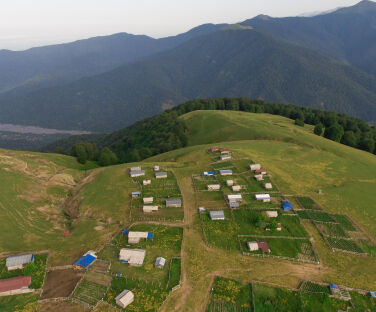
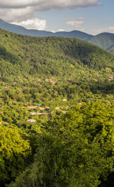
After about a 3.5km ascent from the starting point through the forest, the path leading to the plateau separates off from the road to the left. The clear, winding trail opens up after 2km, passes 600m beyond a campsite and reaches the Honzogor plateau.
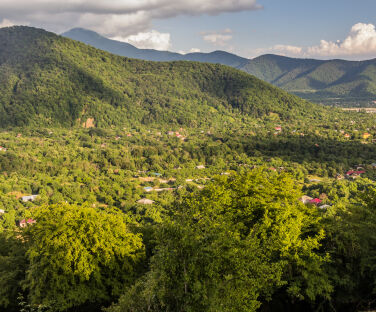
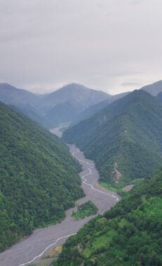
The path leading to the village of Jar begins at the western end of the plateau. Continuing on a slightly inclined slope on the left of a ridge which extends towards the mountains, after 2km the path passes between two hills and begins to descend, going to the right of the ridge. The winding path, which descends along a ridge flanked by forest valleys on both sides, descends about 4km to the left into a forest, and then goes another 2km to a small river gorge at the top of the village. The trail then continues along the river, crossing to the opposite side and reaching the village. After crossing the river, follow the signs to the central road of the village.
It is physically less demanding to hike this route starting from Jar village.
Nearby trails
Due to the fact that the surrounding areas are the Zagatala State Reserve and border protection zone, it is highly advised to only walk on marked trails.
Seasonality
May-September is the best time in terms of weather and length of the day. Along the route, there is a cluster of 20-30 shepherd shelters on the Honzogor plateau alone. Shepherd dogs can be dangerous but not during the day when there are a lot of people around. In May and September, you can check with the local community to see if the shepherds are in the mountains. These huts can be a warm shelter and you can ask for information from the shepherds, but you need to be careful around shepherd dogs. If you do not have a tent, you can ask the shepherds to stay in one of the empty shelters (usually an empty shelter). In other seasons, you can find an empty shelter.
In general, although it is possible to do this hike throughout the year, it requires more preparation in winter months. In winter, spring and autumn, it is important to check the weather forecast more carefully and prepare food, clothing, equipment (tents, sleeping bags, etc.) accordingly. On cold and short winter days, it is very difficult and risky to finish this route in one day, so it is not recommended to leave without proper camping equipment.
Food and accommodation
In both villages there are small shops, cafes and restaurants.
Water
There are at least three water sources along the trail. It is sufficient to take 1-2 litres of water per person to go to the plateau. The springs along the way and at the pasture will help maintain your water supply.
Transportation
From Zagatala you can get to Gabizdere by minibus (0.60 AZN per trip) or taxi (4-6 AZN). From the city centre to the restaurant “Şəlalə” (at the entrance of Gabizdere) is about 4 AZN, while to the restaurant “Gedim Gabizdere” (at the end of the village) is about 6 AZN.
Permits and specially protected areas
No prior permission is required to walk on this route. The route does not pass through specially protected natural areas or the border protection zone, and there are no permanent border guard posts anywhere along the route. When encountering border guards, it is necessary to show your documents and explain your route.


